Posted on December 6, 2017 by Mariangela
Supporting the local urban planning process in Kolkata (India)
In line with the Millennium Development Goals, Indian Prime Minister Modi launched three major urban development initiatives in June 2015 which are handled by the Ministry of Urban Development (MoUD), in addition to several other programs like the National Urban Information System (NUIS) or the Swachh Bharat Mission initiated in October 2014.
In this framework, the “Kolkata Environmental Improvement Investment Program” funded by the Asian Development Bank (ADB) takes an active part for improving land-use management and urban planning in a sustainable way for Kolkata. Specifically, the Program focuses on water supply for the municipality and property mapping, and has in the Kolkata Municipal Corporation (KMC) – an ADB’s long-time partner – one of its main stakeholders.
ADB is convinced that EO4SD-Urban products can be very helpful to KMC – which is already familiar with GIS tools. Moreover, they can also be of great support to other public actors involved in the local urban planning process as the Kolkata Metropolitan Development Authority (KMDA) representing 19 municipalities and various other local state-level administrations.
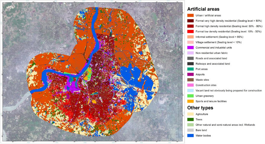
Here, precise mapping of informal settlements shall contribute to better targeting priorities for the planned infrastructure while land-cover and land-use maps shall provide a major contribution in the identification of areas prone to disasters hence strengthening climate resilience.


