Posted on March 29, 2018 by Mariangela
EO4SD-Urban @ World Bank Land & Poverty Conference 2018
GAF AG, GISAT and SIRS from the EO4SD Urban Consortium attended the World Bank Land & Poverty Conference 2018 and showed the results of the collaborative work carried out in Phase 1 of the project with Multi-Lateral Development Banks, especially the World Bank (WB). Presentations were given in Session 11-08 Using Satellite Imagery for Urban Change Detection which took place on Thursday 22nd March.
The project leader Dr. Thomas Haeusler from GAF AG had a talk on Earth Observation For Urban Sustainable Development: Advancements For Supporting Land Use Planning In Urban Areas, where Phase 1 main achievements have been highlighted. In particular, the geo-spatial products generated so far for 16 test cities have been presented, with focus on selected examples of the Land Use/Land Cover maps derived for the 4 Tanzanian case studies (i.e., Arusha, Dar es Salaam, Dodoma and Kigoma). Furthermore, potential analytics from the developed layers in support to the UN Sustainable Development Goal 11 have also been discussed.
In the same session, Tomas Soukup from GISAT had a talk on Peering into Megacities from Space, where results from the work performed by the Consortium sustaining the WB Urbanscape programme have been presented. Specifically, it has been shown how the effective use of geospatial information from very high resolution (VHR) EO data shall contribute to a better understanding of urban spaces and might help transforming urban environments by promoting inclusive green growth and enhancing liveability in megacities. The examples provided focused on the Karachi (Pakistan) and Dhaka (Bangladesh) test cases.
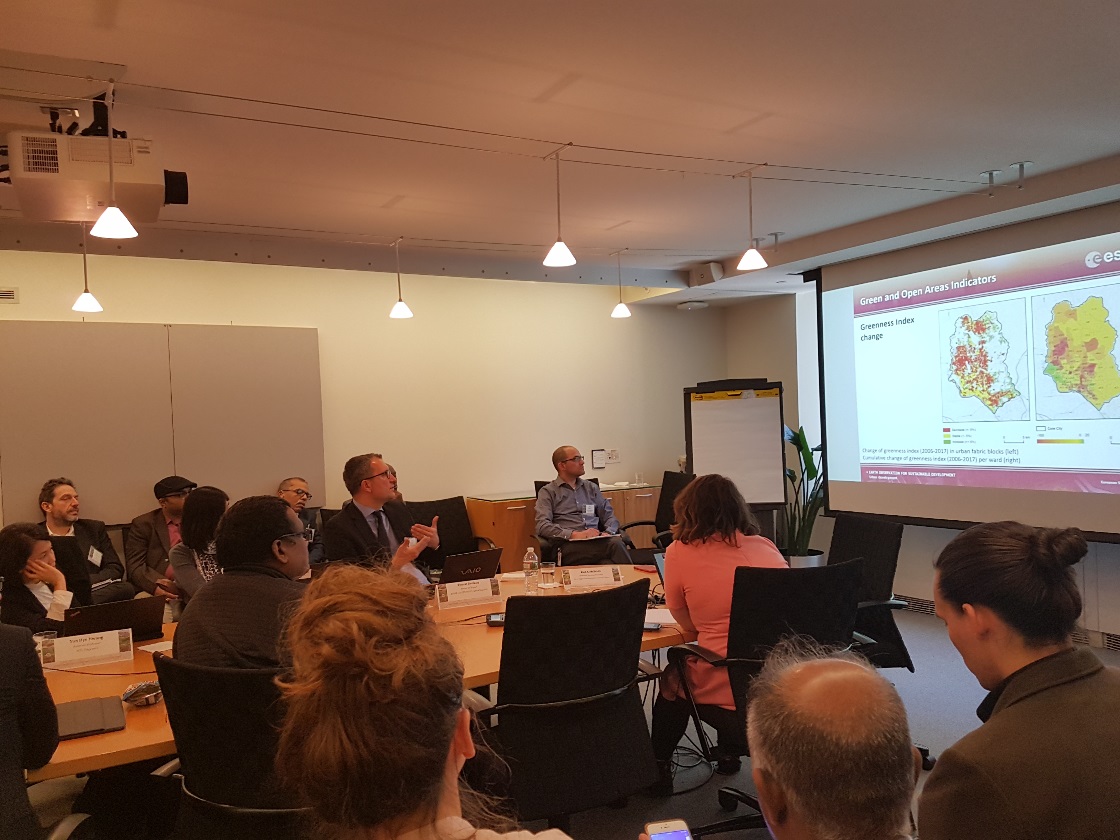
Tomas Soukup (GISAT) discussing the utility of EO4SD Urban products for the World Bank Urbanscapes programme at the World Bank Land & Poverty Conference 2018 [Session 11-08: Using Satellite Imagery for Urban Change Detection]
The representatives of EO4SD Urban Consortium also had the chance for further discussing about the work envisaged for Phase 2 with key WB stakeholders, which provided very positive feedback on the utility of the products generated so far within different WB programmes. Moreover, the event provided a very good opportunity for outreach activities and promoting the project to new potential end-users attending the conference.
Relevant to the EO4SD programme was the clear recognition by the WB of the key role of EO in support to land-use and urban planning applications as emerged during the pre-Conference session Improving generation & access to land related data from different sources, which took place on 19th March. Here, the ESA WB Secondee Dr. Chris Aubrecht also presented the ESA Urban Thematic Exploitation Platform (U-TEP), a Big Data infrastructure offering on-line processing and analytics services for urban applications. The U-TEP seeks to provide an end-to-end analysis platform for a broad spectrum of users – both expert and non-expert – to produce and extract urban information needed for sustainable urban management.